Shire Flood Mapping information now available
Published on 15 November 2023
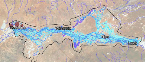
Flood Mapping information for Central Darling Shire is now available on Council’s website. The flood mapping takes in the section of the Darling River located between the towns of Louth and Menindee.
Media-Release-Flood-Mapping.pdf(PDF, 137KB)